A sustainable, landscape-led development delivering 1,800 new homes, community facilities, and extensive green spaces for North Walsham
North Walsham West is a 108-hectare development allocated in North Norfolk District Council's Local Plan, designed to create a sustainable extension to North Walsham that integrates seamlessly with the existing community.
Diverse housing to meet local needs, including affordable homes and accommodation for older residents
2-form entry primary school centrally located to serve the growing community
7 hectares of serviced employment land creating local job opportunities
Over 17 hectares of public open space, including parks, sports pitches, and allotments
Creating a sustainable settlement that provides housing for the whole population, within a strong green infrastructure network, responding proactively to climate change.
Comprehensive green infrastructure strategy creating multifunctional open spaces for recreation, biodiversity, and sustainable transport
Community facilities at the heart of the masterplan with inclusive access to amenities, employment, and open spaces
Seamless integration of built and natural environment supporting overall wellbeing and high quality of life
Residents can access everyday needs within a pleasant 15-minute walk or cycle, promoting healthier, sustainable living
The 108-hectare site is located on the western edge of North Walsham, with excellent connectivity to the town centre, rail station, and surrounding countryside.
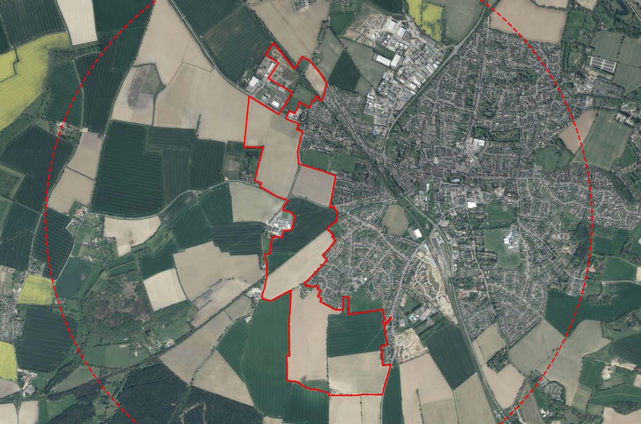
Aerial view of the North Walsham West development site showing site boundaries
Detailed site maps and boundary plans are available in the official consultation documents.
View Site Plans →Dedicated pedestrian and cycle routes connecting to town centre, rail station, and surrounding areas
Enhanced biodiversity through strategic landscaping and habitat creation
Western link road connecting Norwich Road to Cromer Road, easing town centre traffic
Integrated water management with sustainable drainage systems throughout
High environmental standards with focus on energy efficiency and carbon reduction
Careful consideration of nearby heritage assets including Bradmoor Farm
The development consortium is engaging with the community throughout the planning process.
Residents are invited to learn about the development plans and provide feedback. The project team will be available to discuss proposals and answer questions.
North Walsham Community Centre
Monday 8 December 2025
15:30 - 19:30
Access official planning documents and consultation materials:
Official Consultation Website →